Live Aircraft Tracker Near You
See real aircraft currently flying near your location right now, using live public ADS-B flight-tracking data · free, no signup
How Live Aircraft Tracker Near You works, step by step
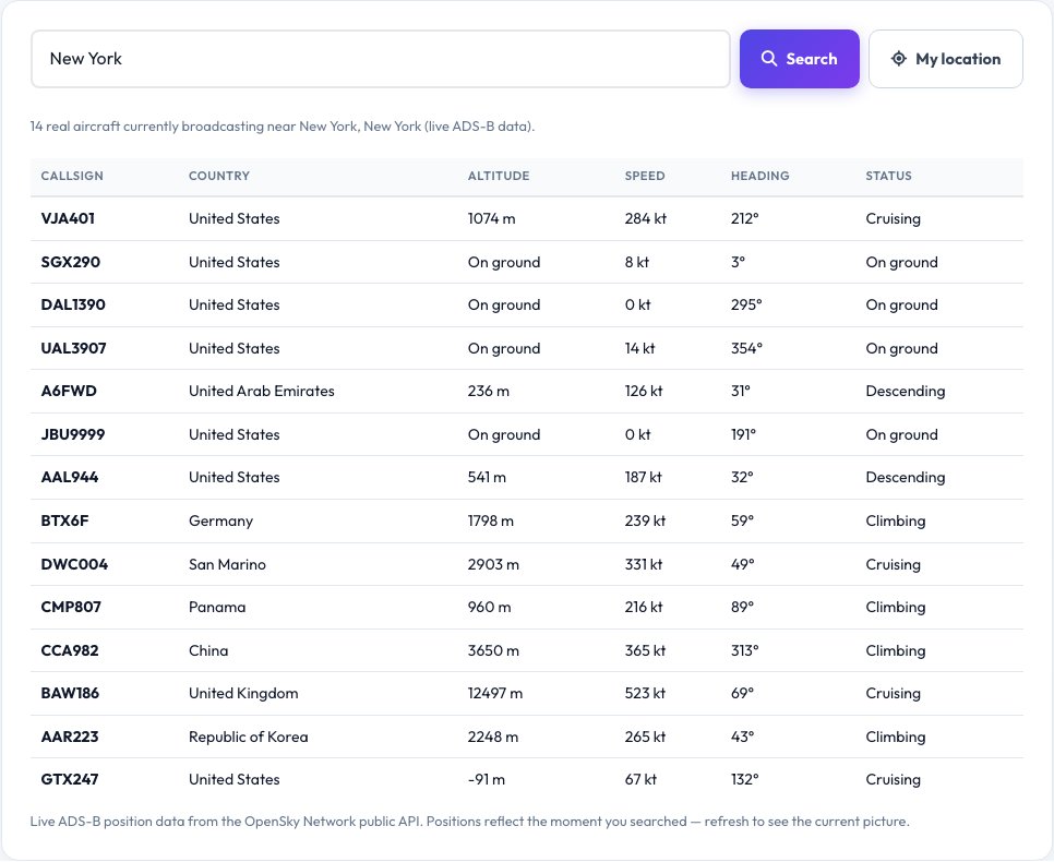
Search a location or allow your current location.
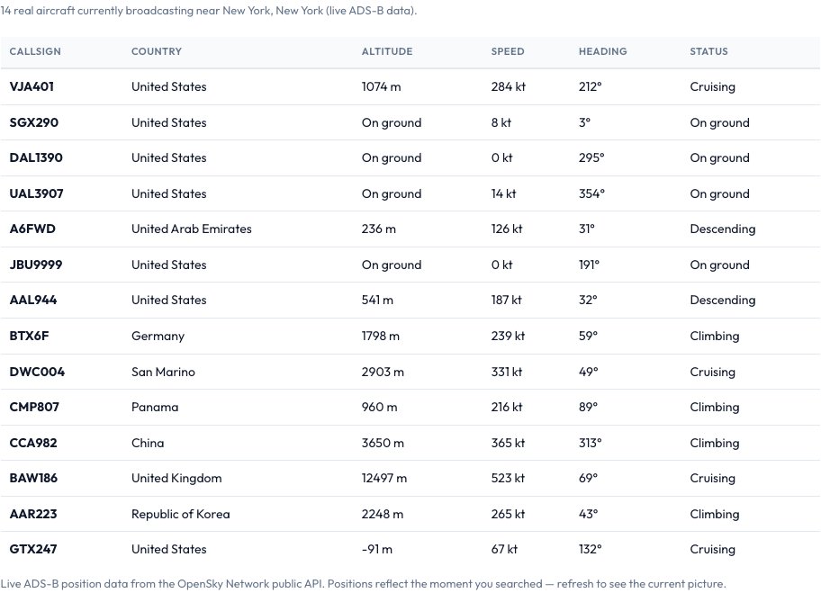 Download it
The tool queries a live public ADS-B network for aircraft near that point right now.
Live Aircraft Tracker Near You
Ever look up and wonder what that plane flying overhead actually is? This tool answers that with genuinely live data: it queries a public ADS-B flight-tracking network's real-time aircraft position feed for a bounding box around your searched or detected location and lists every aircraft currently broadcasting its position nearby — real callsign, altitude, ground speed, heading and origin country, refreshed on demand.
This is a different capability from a flight-number status lookup (which tells you a specific known flight's schedule and gate) — this tool instead answers 'what's flying near me right now', based on live, real ADS-B transponder data from aircraft currently in the air, which is fundamentally live, real-world information no chatbot could know without querying it at that exact moment.
Key features
Genuinely live ADS-B data
Real aircraft positions currently being broadcast near your location, not a schedule or historical lookup.
Real flight details per aircraft
Callsign, altitude, ground speed, heading and origin country for every nearby aircraft.
Any location, searched or detected
Check any city worldwide or use your current location for aircraft nearby right now.
A genuinely different tool from flight-status lookup
Answers 'what's overhead now', not 'what's the status of flight XY123'.
How to use it
- Search a location or allow your current location.
- The tool queries a live public ADS-B network for aircraft near that point right now.
- See the real, current list of nearby aircraft with altitude, speed, heading and callsign.
- Refresh anytime to see the live picture update as aircraft move.
Worked example
Example
Searching a location near a major airport during a busy period might return 12-20 real aircraft currently broadcasting positions within range — from a climbing departure at 4,000 feet and 210 knots to a cruising aircraft passing through at 36,000 feet — every entry a real, live position at the moment of the check, not a scheduled timetable.
Who uses this tool
Anyone curious what plane is flying overhead right now
Get a real, live answer instead of guessing from the sound or shape.
Aviation enthusiasts (plane spotters)
See real, live nearby traffic without needing dedicated tracking hardware.
Anyone near an airport curious about current traffic
See a real live snapshot of aircraft currently in the area.
Tips for the best results
- Coverage depends on the public ADS-B network having a receiver nearby — well-covered regions (most of North America, Europe, and many other populated areas) show dense real traffic, while sparsely covered regions may show few or no aircraft even when planes are genuinely overhead.
- Military and some other aircraft may not broadcast a public position and won't appear even if physically present.
- The data reflects the exact moment you check — refresh to see the live picture update, since aircraft positions change by the minute.
Common mistakes to avoid
- Expecting every physical aircraft overhead to appear — only aircraft broadcasting a publicly received ADS-B signal are shown, which excludes some aircraft types and under-covered areas.
- Confusing this with a flight-status-by-number lookup — this tool shows real live positions near a place, not a specific flight's schedule or gate information.
- Assuming a stale-looking result means the tool is broken — refresh to pull the current live snapshot, since aircraft positions are only accurate at the moment of each check.
Why use AZRS QuickFix?
It is 100% free, needs no signup and has no watermark or usage limits. The tool runs in your browser, so what you type stays on your device, and it works on phones, tablets and desktops. New tools are added every week — bookmark this page or browse the full QuickFix toolbox.
Frequently asked questions
Is this really live, or delayed/simulated data?
It's real, live ADS-B position data queried from a public flight-tracking network's live feed at the moment you run the check — not a simulation, schedule or historical replay.
How is this different from a flight-status lookup?
A flight-status tool answers 'what's the status of flight XY123' using a schedule/status database. This tool instead answers 'what aircraft are physically near this location right now', using live, real-time ADS-B position broadcasts — a genuinely different kind of data and question.
Why don't I see any aircraft in my area?
Either there are genuinely none currently broadcasting nearby, or the public ADS-B network's ground-receiver coverage is sparse in that specific area — coverage is real but uneven, denser near populated regions and major air routes.
Does it show private or military aircraft?
Only aircraft that are actually broadcasting a public ADS-B position; some military and other aircraft operate without public position broadcasting and won't appear even if present.
Is my exact location sent anywhere?
Only the coordinates needed to query nearby aircraft are sent to the live flight-tracking network's public data feed, and only when you choose to search or share your location.
Is my data stored?
No, nothing is saved after you leave the page.