NASA captures dense valley fog over Appalachian Plateau on September 12
NASA's satellite images captured dense valley fog over the Appalachian Plateau on September 12, 2024, affecting a 12,000-square-mile area and reducing visibility. This data will enhance fog forecasts…
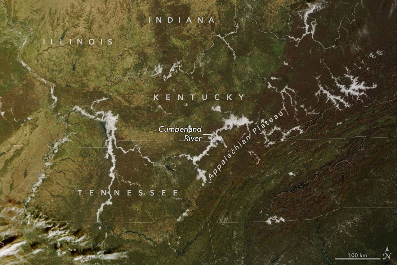
NASA satellite images show low clouds forming a dense fog over the Appalachian Plateau and the Cumberland River valley in early autumn, clearing by midafternoon. The fog appeared over the eastern United States on September 12, 2024, and was captured by the GOES‑16 geostationary satellite. It spread across a 12,000‑square‑mile area, lowering cloud bases to about 200 meters. The images were released by the National Aeronautics and Space Administration’s Earth Observation Laboratory.
Valley fog is a familiar sight for residents of the Appalachian region, but its precise timing and extent have long been difficult to track. The combination of cool nighttime temperatures, high humidity from recent rainfall, and the valley’s topography traps moisture near the ground. This creates a shallow cloud layer that can reduce visibility to less than 500 meters. For motorists, the fog can trigger accidents, and for farmers, it can delay harvesting or affect crop quality. The data also show that fog can trap air‑pollution particles, worsening local air quality. Scientists note that climate change may be increasing the frequency of such events by altering temperature and precipitation patterns.
The new satellite imagery will feed into the National Weather Service’s fog‑forecast models. Meteorologists can refine their predictions for visibility and temperature inversions, allowing better warnings for road safety and aviation. The data also help climate scientists study how topography influences fog formation, improving regional climate projections. Local authorities in Kentucky, West Virginia, and Tennessee plan to use the forecasts to issue real‑time alerts. As the fog dissipated by afternoon, the study demonstrates the value of high‑resolution satellite monitoring for protecting communities and understanding climate‑related weather phenomena.
Read Full Story at NASA →